DE LA POER TOWER LOOP
Type of route: Loop Walk (Woodland paths and local road)
Distance: 4.53 km
Total Climb: 20m
Estimated time to complete: 1 hr
Grading: Easy
“The view from this tower, and from the ground about it, is one of the finest in Ireland “[1].
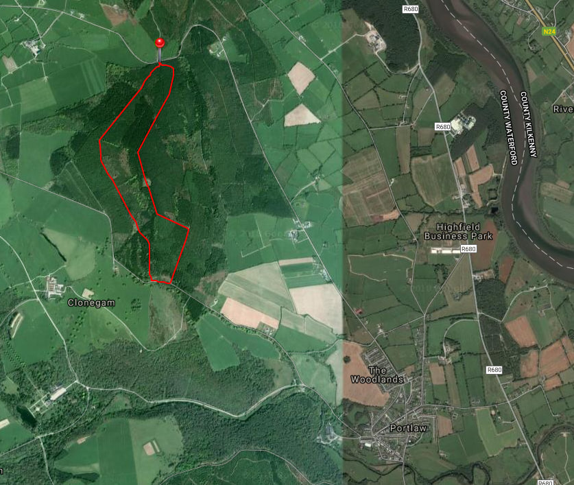
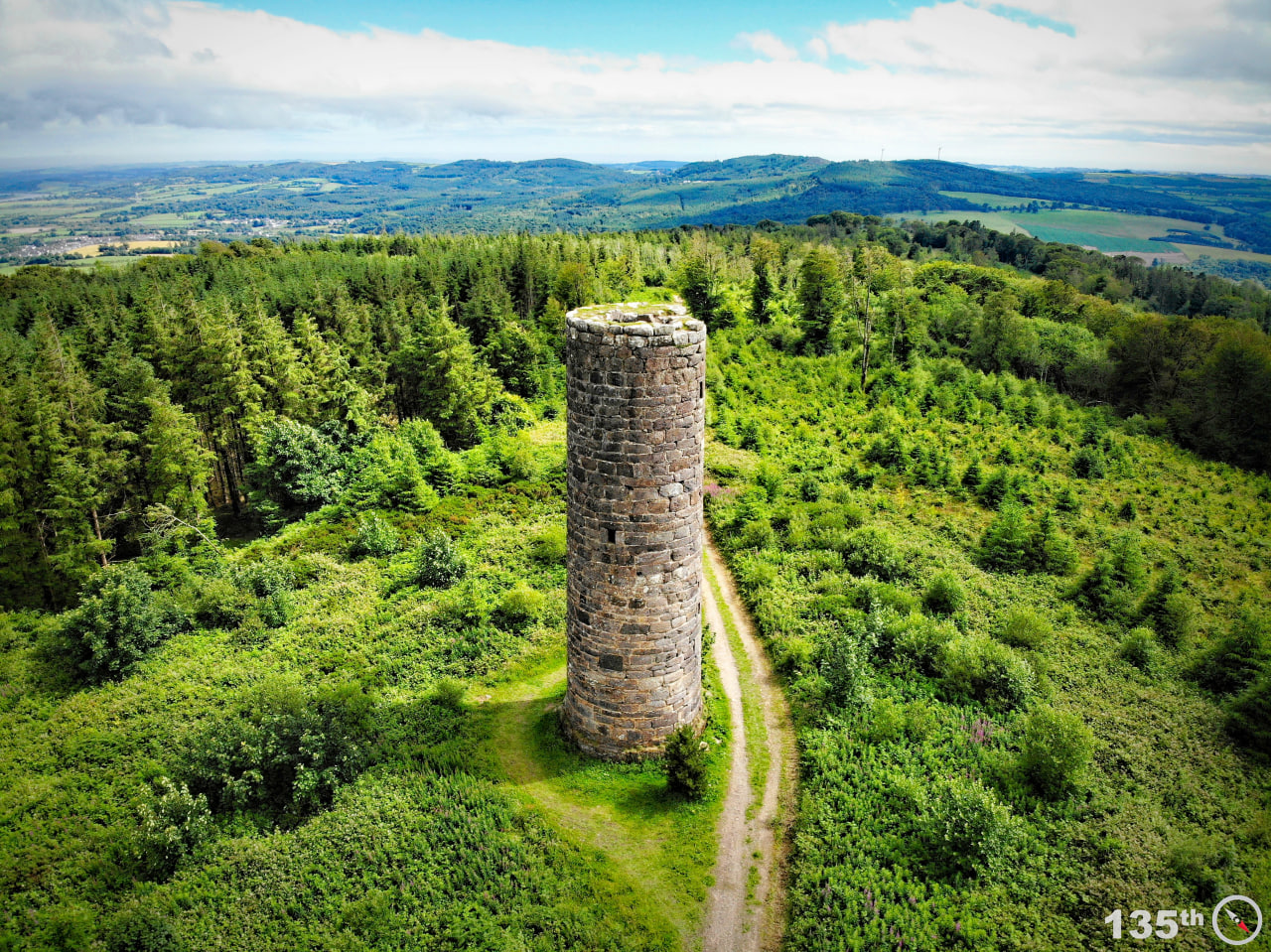
This walk begins at Tower hill car park at the highest point of the Scrouty road. Interestingly Tower hill is also known locally as the ‘Black door’ due to there being an old wooden door entrance to the woods nearby. This walk is predominantly a woodland trek but does take in a short section of local road. There is evidence of delightful stone boundary walls around the route which predate much of the woodland. The main feature of the trail is the standout local landmark, De La Poer Tower, a folly built in 1785 by the first Marquis of Waterford, George De La Poer Beresford, Earl of Tyrone, in memory of his son who died in a horse riding accident [2].
EXAMPLE OF THE ORIGINAL FIELD BOUNDARY WALLS THAT STILL EXIST IN PORTLAW WOODS. (IMAGE: AUTHOR, 2014).
At the ‘black door’ entrance to Tower hill woods walk a few metres straight ahead and take the first pathway to the right. This walk is short so can be savoured at a leisurely pace, enjoying the peaceful natural surroundings. After a few hundred metres and slight descent you will meet a pathway that leads to the right. Do not take this route but keep walking straight ahead. From here until you reach the exit to the local road there are no deviations on your route.
EXAMPLE OF THE WOODLAND PATHWAY ON THE DE LA POER LOOP TRAIL. (IMAGE: AUTHOR, 2015).
Tower hill woods cSAC (candidate for Special Area of Conservation) are filled with wildwood, mixed deciduous and coniferous trees, with an ivy, holly, bramble and hazel undergrowth. The woods are a fine example of mature oak woodland, representing one of the larger remaining tracts of oak wood in the country. According to the Portlaw Local Area Plan 2014-2020, there exists the rare lichen Lobaria pulmonaria which is an indicator of ancient woodlands in the area [3].
Having enjoyed your woodland walk you come upon an exit to the local road. This exit is atop of Clonegam which looks down to Curraghmore Estate. This exit is known locally as the ‘Hussian Gap’. Speaking with many locals it appears the exact origins of the name is unclear and it is not documented officially. However, many of the Marquess of Waterford, down through the years, have been involved in military life and it is plausible a connection lies with the 8th King’s Royal Irish Hussars. The word Hussar may have been misread, misheard or misinterpreted and ended up becoming the ‘Hussian Gap’. Another interesting local fact about the Hussian Gap is that one of the Marquess, during the 19th century, had a horse that he used during military battles. The horse was a military charger named Jock. The story goes that when ‘Jock the Charger’ died the Marquis was so attached to the horse, and held it in such high esteem, that he buried the horse at the Hussian Gap, inside the boundary walls of the woods. It is more than possible that the charger and the Marquis served in battle at some point. The general story is true as, up to very recently, the headstone for Jock the Charger was still intact, covered by briars and brambles. Tree felling began and in the process a tree landed on the headstone and and broke it in half. It was removed by the present Marquis of Waterford and brought to Curraghmore Estate House for safekeeping.
After you exit the Hussian Gap turn left, and after a short walk there is another entrance to Tower hill woods on the left. Take this route for a few hundred metres on flat woodland paths until you meet a turn to the left which you take. It is but a short walk until you reach De La Poer Tower.
SPECTACULAR AERIAL FOOTAGE OF DE LA POER TOWER, CURRAGHMORE ESTATE AND THE SUIR VALLEY. (FILM: WATERFORD, 2016).
“a fine monument of national importance, built by George De La Poer Beresford, Earl of Tyrone (1735 – 1800), forming an imposing landmark in the locality. Inspired by the medieval Irish round tower, the monument alludes to the contemporary taste for indigenous architectural styles. The construction of the tower is particularly important, large courses of squared rubble masonry forming walls up to seven feet thick. The spiral staircase to the interior is also of some technical merit.”
De La Poer Tower is about 70 ft high. It was built in 1785 by the First Marquis of Curraghmore in memory of his eldest son who was killed jumping his horse over courtyard railings. He was only thirteen. Local historian William Power claims that the origins of the tower are somewhat different to its present position as a memorial. He says that it was originally built as a folly with the intention to be built 90 ft high. Adjoining the tower there was to be an additional folly in the appearance of an old ruined Church. However, after the tragic accident all previous plans were abandoned[5].
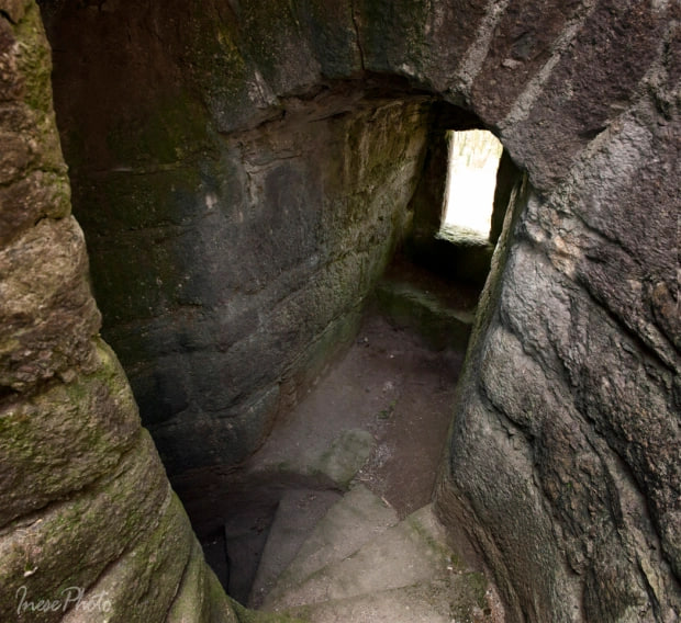
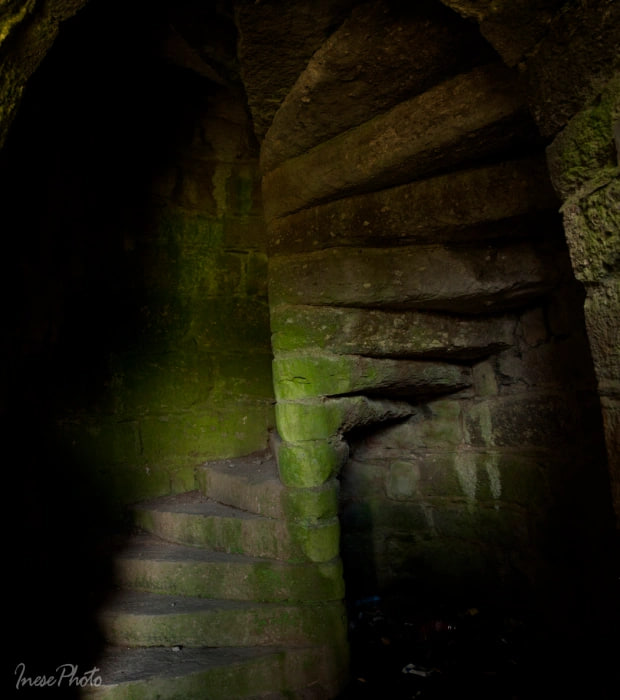
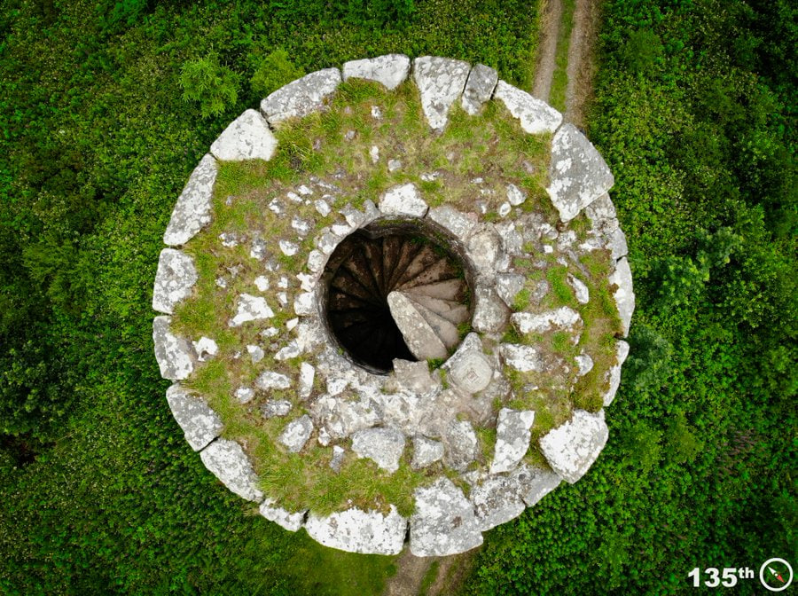
A spiral stairway with 92 steps leads to the top of the tower. These steps are said to have come from the ruins of Clonea Castle[6]. On a clear day, you can see five counties from the top: Wexford, Carlow, Tipperary, Kilkenny and Waterford. In addition there are incredible views of the Comeragh Mountains, Curraghmore Estate and Sliabh na Mbán in Tipperary to the north-west. It is said that at the point when the tower comes into view on the trail, there used to be a hedge school at the turn of the pathway.
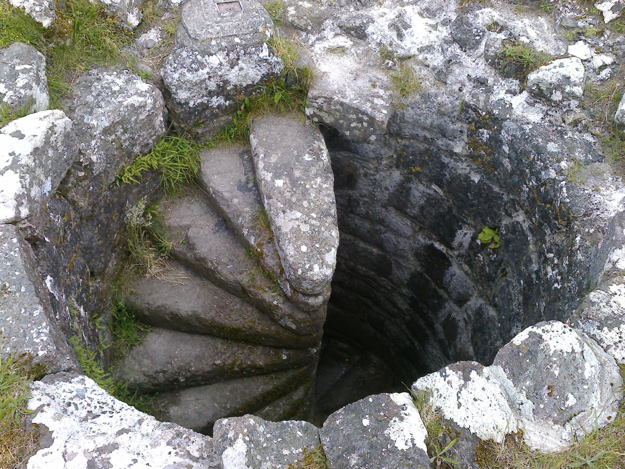
AN EXAMPLE OF THE STONE WORK ON THE STEPS WITHIN THE TOWER. (IMAGE: AUTHOR, 2014)
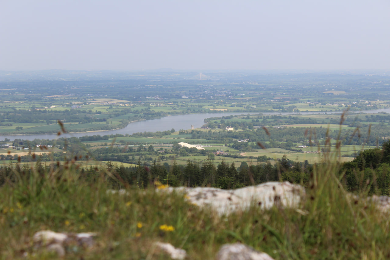
VIEW OF ROCKETTS CASTLE, BY THE BANKS OF THE RIVER SUIR, TAKEN FROM DE LA POER TOWER. (IMAGE: AUTHOR, 2015)
Note the inscription on the tower that reads:
“La Poer Tower, erected in the year 1785 by George, Earl of Tyrone, to his beloved son, his niece and a friend.”
The “friend” is supposed to be Mr. Charles Poliere de Botens, the boy’s tutor at Curraghmore, who died at Curraghmore a short time after his pupil’s death [7].
Having enjoyed the splendours of the tower continue on the trail, keeping to a straight route for approx. 1 km until you are back at the black door entrance to the woods.
This walk is of reasonable length for a relaxing walk at just over 4.5 km that begins and ends at the black door entrance to Tower hill woods. It is a looped walk taking in woodlands and local roads with little or no traffic. It is an easy walk with no major steep trekking. All of the trails in the Portlaw area are mapped and measured with difficulty levels, short descriptions and photos accompanying. They can be accessed through the walking routes.ie website by searching under Waterford county trails.
